
 Continue with onX Maps
 Continue with Facebook


 Particularly Special Place


 Intermediate
Intermediate
Intermediate
 Intermediate
Local Club: Friends of Pathways (FOP)
Jun 16, 2023: Trail Conditions 6-16-23
Jun 10, 2023: Trail Conditions for 6-9-23
Jun 2, 2023: Trail Conditions for 6-2-23
Land Manager: USFS - Bridger Teton National Forest Office
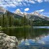
 Phelps Lake Loop
8.4 mi 13.5 km • 787' Up 240.02 m Up • 788' Down 240.21 m Down

 Moose W…, WY
 Death Canyon & Static Peak Divide to Teton Canyon
19.6 mi 31.6 km • 4,383' Up 1335.98 m Up • 4,231' Down 1289.52 m Down
Moose W…, WY
Mt. Baird Out and Back
9.2 mi 14.9 km • 3,934' Up 1198.94 m Up • 3,933' Down 1198.76 m Down
Victor, ID
Bradley - Taggart
6.2 mi 9.9 km • 656' Up 199.81 m Up • 660' Down 201.26 m Down
Jackson, WY
 Lake Solitude
14.2 mi 22.8 km • 2,246' Up 684.47 m Up • 2,246' Down 684.46 m Down
Jackson, WY
 Bearpaw and Trapper Lakes
9.8 mi 15.8 km • 179' Up 54.41 m Up • 179' Down 54.41 m Down


0 Comments