
 Continue with onX Maps
 Continue with Facebook


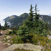
 Particularly Special Place


 Easy
Easy

 Easy
Easy
Land Manager: Washington State Parks - Olallie State Park
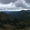
 Kendall Katwalk
12.2 mi 19.7 km • 2,621' Up 798.78 m Up • 2,620' Down 798.61 m Down
 Riverbend, WA
Bandera Mountain
Riverbend, WA
Bandera Mountain
8.2 mi 13.1 km • 3,055' Up 931.15 m Up • 3,054' Down 931.01 m Down
Riverbend, WA
 Thorp Mountain via Knox Creek
4.3 mi 6.9 km • 2,034' Up 619.98 m Up • 2,034' Down 619.9 m Down
Mailbox Peak Trail
9.7 mi 15.5 km • 3,848' Up 1173.02 m Up • 3,848' Down 1172.73 m Down
Riverbend, WA
 Deception Falls Loop
0.8 mi 1.3 km • 81' Up 24.82 m Up • 76' Down 23.29 m Down
Skykomish, WA
 Lake Youngs Trail
9.4 mi 15.1 km • 860' Up 262.06 m Up • 862' Down 262.88 m Down


0 Comments