
 Continue with onX Maps
 Continue with Facebook


 Particularly Special Place


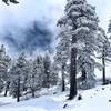
 Difficult
Difficult
Difficult
 Difficult
Local Club: San Gabriel Mountains Trailbuilders (SGMTB)
Land Manager: USFS - Angeles National Forest Office
 Hawkins Ridge Loop
11.2 mi 18.1 km • 2,855' Up 870.34 m Up • 2,855' Down 870.25 m Down

 Wrightwood, CA
 Mt. Baden-Powell from Vincent Gap
8.1 mi 13.0 km • 2,743' Up 836.13 m Up • 2,742' Down 835.81 m Down
Wrightwood, CA
 San Antonio Falls
1.3 mi 2.1 km • 258' Up 78.63 m Up • 258' Down 78.53 m Down
Cucamonga Peak via Icehouse Canyon
11.4 mi 18.3 km • 4,051' Up 1234.84 m Up • 4,055' Down 1235.91 m Down
San Ant…, CA
Three T's - Mt. Baldy
16.6 mi 26.7 km • 6,779' Up 2066.37 m Up • 5,627' Down 1715.11 m Down
San Ant…, CA
Bonelli Trail
10.3 mi 16.6 km • 1,092' Up 332.83 m Up • 1,092' Down 332.93 m Down


2 Comments