
 Continue with onX Maps
 Continue with Facebook


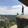
 Particularly Special Place


 Easy
Easy

 Easy
Easy
Land Manager: USFS - Pikes Peak Ranger District
 Winding Stairs Loop
5.9 mi 9.6 km • 1,564' Up 476.81 m Up • 1,570' Down 478.64 m Down
 Palmer…, CO
 Limbaugh Canyon/Reservoir Loop
5.6 mi 8.9 km • 973' Up 296.65 m Up • 1,005' Down 306.28 m Down
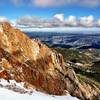
 Pikes Peak Northwest Slopes
6.6 mi 10.6 km • 4,123' Up 1256.58 m Up • 27' Down 8.28 m Down
Cascade…, CO
Dome Rock Loop Trail
10.8 mi 17.4 km • 1,590' Up 484.7 m Up • 1,583' Down 482.47 m Down
Cripple…, CO
Ute Valley Loop
3.8 mi 6.2 km • 327' Up 99.73 m Up • 325' Down 99.13 m Down
Hogback Ridge Summit via Quarry Pass
4.1 mi 6.6 km • 518' Up 157.87 m Up • 521' Down 158.83 m Down
Manitou…, CO


0 Comments