Hiking Project Logo

Good views of the valley down low, pleasant forest up high, and a surprisingly worthwhile summit.


Your Rating: Rating Rating Rating Rating Rating      Clear Rating
Your Difficulty:
Your Favorites: Add To-Do · Your List
Zoom in to see details
Map Key

2.5

Miles

4.0

KM

Point to Point

10,328' 3,148 m

High

9,341' 2,847 m

Low

1,007' 307 m

Up

132' 40 m

Down

9%

Avg Grade (5°)

24%

Max Grade (13°)

Dogs Unknown

Features Fall Colors · Spring · Views · Wildflowers · Wildlife

Description

While it seems Strand Hill is primarily enjoyed by mountain bikers on the 4.5 mile Stand Hill loop, this alternative out-and-back makes an enjoyable hike to a hidden gem of a summit. The bike loop avoids the final ascent to the summit, and thus you'll likely be alone for the latter half of the hike.

Begin From Brush Creek Road at a small pullout a few hundred feet before the Strand Hill trail/dirt road ascends to the east. About 3/4 of a mile up, take a left turn following signs for Strand Hill. You'll soon hit another signed trail where you'll want to stay right for Strand Hill (left is the Strand Bonus trail). Once you enter the forest, enjoy some shade among the aspens and lodgepole pines as you climb up to yet another signed junction where the Strand Hill loop goes left. While the mountain bikers will start their cruise down the singletrack, you'll want to stay right on the doubletrack, where you'll likely find solitude.

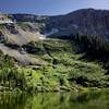
The grade steepens for a bit before making a sharp right, then a sharp left at a small clearing where you might spot a fire ring if you look around. The unimpressive true summit of Strand Hill is above this small clearing, but the reward lies another 3/4 of a mile north along a forested ridge. Follow the trail as you descend to a small saddle where the trees start to clear, and a glorious view emerges. Teocalli Mountain and the beautiful red Elk Mountains stand majestic to the north, while Mt. Crested Butte and the green valley around it grace the west and south.

While this is clearly no comparison to a high alpine peak, the 360 degree view from here is among the best I've seen from a sub-alpine Colorado summit. The mid-june greenery and wildflowers and the lightly snow-capped peaks are spectacular.

Contacts

Shared By:

Aaron Glasenapp

Trail Ratings

  4.0 from 1 vote

#16564

Overall
  4.0 from 1 vote
5 Star
0%
4 Star
100%
3 Star
0%
2 Star
0%
1 Star
0%
Trail Rankings

#1,438

in Colorado

#16,564

Overall
2 Views Last Month
370 Since Jun 19, 2017
Intermediate Intermediate

0%
0%
100%
0%
0%
0%

0 Comments

Weather


Current Trail Conditions

Unknown
Add Your Check-In

Check-Ins

none
Welcome

Join the Community

Create your FREE account today!
Already have an account? Login to close this notice.

Get Started