
 Continue with onX Maps
 Continue with Facebook


 Particularly Special Place


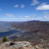
 Intermediate/Difficult
Intermediate/Difficult
Intermediate/Difficult
 Intermediate/Difficult
 Stillman-Bluebird Loop
4.9 mi 7.9 km • 988' Up 301.04 m Up • 987' Down 300.95 m Down

 Manitou to Camp Smith Trail
6.3 mi 10.1 km • 1,650' Up 502.91 m Up • 1,471' Down 448.48 m Down

 Popolopen Gorge - Timp-Torne Loop
4.3 mi 7.0 km • 1,157' Up 352.56 m Up • 1,092' Down 332.84 m Down
Fort Mo…, NY
Bear Mountain Loop
11.2 mi 18.0 km • 2,225' Up 678.29 m Up • 2,224' Down 677.99 m Down
Harriman / Bear Mountain State Park Loop
5.9 mi 9.6 km • 1,170' Up 356.76 m Up • 1,170' Down 356.62 m Down
Manny's Swiss Army Knife Route
15.0 mi 24.1 km • 3,013' Up 918.36 m Up • 3,014' Down 918.66 m Down
Fort Mo…, NY


0 Comments