
 Continue with onX Maps
 Continue with Facebook


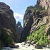
 Particularly Special Place


 Intermediate
Intermediate
Intermediate
 Intermediate
Land Manager: BLM Colorado - Uncompahgre Field Office
 Red Rock Canyon Route
6.5 mi 10.4 km • 1,320' Up 402.37 m Up • 1,319' Down 402.13 m Down

 Rimrock to Uplands Loop
2.2 mi 3.5 km • 404' Up 123.12 m Up • 406' Down 123.82 m Down
 Long Draw (Gulch)
1.8 mi 2.9 km • 1,422' Up 433.33 m Up • 1,422' Down 433.34 m Down
Montrose, CO
North Vista Trail
6.7 mi 10.8 km • 1,169' Up 356.18 m Up • 1,169' Down 356.24 m Down
 Olathe, CO
Alpine Trail- Silver Jack Segment
Olathe, CO
Alpine Trail- Silver Jack Segment
10.8 mi 17.4 km • 2,488' Up 758.35 m Up • 2,487' Down 758.18 m Down
Ridgway, CO
Cascade Falls and the Chief Ouray Mine
5.2 mi 8.3 km • 2,204' Up 671.74 m Up • 2,204' Down 671.82 m Down
Ouray, CO


0 Comments