
 Continue with onX Maps
 Continue with Facebook


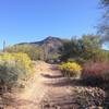
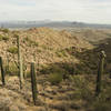
 Particularly Special Place


 Intermediate
Intermediate
Intermediate
 Intermediate
Land Manager: USFS - Tonto National Forest Office
 Maricopa Trail - Pass Mountain Connector
9.4 mi 15.1 km • 538' Up 163.95 m Up • 1,335' Down 406.81 m Down
 Usery Park Large Loop - South Side
7.6 mi 12.2 km • 243' Up 74.17 m Up • 244' Down 74.39 m Down
Usery Mountain Regional Park Medium Loop
6.3 mi 10.1 km • 283' Up 86.3 m Up • 278' Down 84.85 m Down
 Apache…, AZ
Usery Mountain Regional Park Southeast Trails Loop
Apache…, AZ
Usery Mountain Regional Park Southeast Trails Loop
7.5 mi 12.0 km • 317' Up 96.52 m Up • 319' Down 97.13 m Down
 Sunrise to Andrews Kinsey Out-and-Back
9.1 mi 14.6 km • 1,476' Up 449.81 m Up • 1,475' Down 449.7 m Down
Fountai…, AZ
Second Water > Boulder Canyon > Dutchman
11.7 mi 18.8 km • 987' Up 300.69 m Up • 993' Down 302.59 m Down


0 Comments