
 Continue with onX Maps
 Continue with Facebook


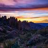
 Particularly Special Place


 Easy
Easy
Easy
Easy
 Easy
Easy
Land Manager: Maricopa County Parks
 Usery Mountain Regional Park Southeast Trails Loop
7.5 mi 12.0 km • 317' Up 96.52 m Up • 319' Down 97.13 m Down

 Peak of Interest Loop
9.4 mi 15.1 km • 2,191' Up 667.86 m Up • 2,191' Down 667.73 m Down
 Maricopa Trail: Usery Mountain Visitor's Center to Bulldog
13.1 mi 21.1 km • 1,079' Up 328.87 m Up • 1,079' Down 328.94 m Down
Superstition Ridgeline
11.4 mi 18.3 km • 3,525' Up 1074.51 m Up • 3,377' Down 1029.35 m Down
Apache…, AZ
 Second Water/Black Mesa/Dutchman Loop
9.3 mi 14.9 km • 994' Up 302.89 m Up • 994' Down 303.06 m Down
Apache…, AZ
Second Water > Boulder Canyon > Dutchman
11.7 mi 18.8 km • 987' Up 300.69 m Up • 993' Down 302.59 m Down


0 Comments