
 Continue with onX Maps
 Continue with Facebook


 Particularly Special Place


 Intermediate


 Intermediate
Land Manager: San Mateo County Department of Parks
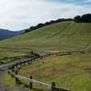
 Edgewood Nature Preserve Loop
5.7 mi 9.2 km • 1,034' Up 315.3 m Up • 1,028' Down 313.25 m Down
Emerald…, CA
 Stanford Dish: Ranch Road via Piers Gate
2.3 mi 3.7 km • 295' Up 89.99 m Up • 295' Down 89.92 m Down
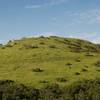
 Hamms Gulch-Spring Ridge Trail Loop
7.7 mi 12.3 km • 1,440' Up 438.85 m Up • 1,439' Down 438.59 m Down
Portola…, CA
Cowell Ranch Beach
1.1 mi 1.8 km • 82' Up 25.09 m Up • 83' Down 25.18 m Down
Arastradero Short Loop
3.4 mi 5.5 km • 421' Up 128.26 m Up • 417' Down 127.03 m Down
Arastradero Preserve Loop
5.3 mi 8.6 km • 626' Up 190.85 m Up • 618' Down 188.28 m Down


0 Comments