Hiking Project Logo

A short trip to a seasonal stream with many options for exploring Mt. Shasta from the end of the trail.


Your Rating: Rating Rating Rating Rating Rating      Clear Rating
Your Difficulty:
Your Favorites: Add To-Do · Your List
Zoom in to see details
Map Key

1.6

Miles

2.6

KM

Point to Point

7,860' 2,396 m

High

7,288' 2,221 m

Low

572' 174 m

Up

0' 0 m

Down

7%

Avg Grade (4°)

12%

Max Grade (7°)

Dogs No Dogs

Features Views · Wildflowers · Wildlife

If traveling above 10,000ft., Summit Passes ($25/person, valid 3 days) are required.

Description

From the parking area, the dusty path winds through the forest, slowly gaining elevation. Enter the Mt. Shasta Wilderness at mile 0.1; about a mile later, views begin to open up through the pines. The views continue to become less peek-a-boo and more spectacular over the next 0.75 miles until the trail crosses the rocky course of Brewer Creek 1.75 miles from the parking area.

Although the official trail ends at Brewer Creek - a seasonal stream that may or may not have water in it - the path turns right to ascend toward Mt. Shasta's cone. From here, the route is unmaintained, and you'll be navigating over uneven terrain. Continue upward for another 2 or so miles to enjoy ever more spectacular views of Mt. Shasta and the surrounding country, even scrambling up to "Butte 9000" as a destination on your hike.

Contacts

Shared By:

Anne Travels

Trail Ratings

  3.5 from 2 votes

#25282

Overall
  3.5 from 2 votes
5 Star
0%
4 Star
50%
3 Star
50%
2 Star
0%
1 Star
0%
Trail Rankings

#2,603

in California

#25,282

Overall
4 Views Last Month
542 Since Jan 14, 2017
Intermediate Intermediate

0%
0%
100%
0%
0%
0%

Photos

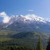
Mt. Shasta towers above from the Brewer Creek Trail.
Jan 14, 2017 near McCloud, CA

0 Comments

Weather


Current Trail Conditions

Unknown
Add Your Check-In

Check-Ins

Jul 21, 2020
BK Hope
Welcome

Join the Community

Create your FREE account today!
Already have an account? Login to close this notice.

Get Started