Hiking Project Logo

This rough abandoned mining road eventually turns into some nice singletrack leading to Cardiff Pass.


Your Rating: Rating Rating Rating Rating Rating      Clear Rating
Your Difficulty:
Your Favorites: Add To-Do · Your List
Zoom in to see details
Map Key

2.2

Miles

3.5

KM

Point to Point

9,968' 3,038 m

High

8,771' 2,673 m

Low

1,197' 365 m

Up

973' 297 m

Down

19%

Avg Grade (11°)

49%

Max Grade (26°)

Dogs No Dogs

Features Views

Description

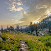
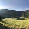
The beginning of this trail actually starts on a paved road past some residences but pretty quickly turns into a pretty rough, rocky dirt road that climbs quickly toward Cardiff Pass. The road appears to be an abandoned mining road with all of the loose rock that covers it in places, but in many places the trail is pretty decent. As the trail gets higher, it gets somewhat steeper (after about 3/4 mile) until it comes out into a small, pretty meadow where the trail more or less levels out briefly, and then starts to ascend steeply again. The last few yards are a sort of scramble as the trail crosses over some rock before reaching Cardiff Pass. From Cardiff Pass, the Mt. Superior Trail can be taken to Mount Superior and Monte Cristo, two great peaks along the Cottonwood Ridgeline.

Another option from Cardiff Pass is to cross over the ridge and descend down into Mill D South. This is a similarly steep and rocky trail, but appears to be less frequently used as the trail can be hard to follow at times. However, the views all around in this beautiful canyon make up for the confusion. The trail generally trends to the west and above the natural drainage in the canyon but crosses a few of the ephemeral streams on its way down.

About 3/4 of a mile down, the trail descends down close to the main drainage and follows it for a short distance until it meets up with an old mining road and then follows that road down until it passes by an old mining site and meets up with the main Mill D South Fork Road.

Contacts

Shared By:

Tomsen Reed

Trail Ratings

  3.8 from 5 votes

#1

in Alta

#15129

Overall
  3.8 from 5 votes
5 Star
20%
4 Star
40%
3 Star
40%
2 Star
0%
1 Star
0%
Trail Rankings

#1

in Alta

#516

in Utah

#15,129

Overall
5 Views Last Month
1,685 Since Dec 15, 2016
Intermediate/Difficult Intermediate/Difficult

0%
0%
33%
0%
67%
0%

Photos

Summer wildflowers (mid-July to late July) at Cardiff Pass, Alta, Utah.
Jul 15, 2022 near Alta, UT
Trail into the clouds.
Nov 5, 2018 near Alta, UT
Snowy and dry sides of the pass.
Nov 5, 2018 near Alta, UT
This is a picture of the the south ridge of superior from the east.
Jul 17, 2021 near Alta, UT

0 Comments

Weather


Current Trail Conditions

Unknown
Add Your Check-In

Check-Ins

Jul 11, 2020
Taylor Y
Oct 13, 2019
Cassie Salzman
Aug 11, 2019
Jake Westover
Oct 25, 2018
Russell Hobart
Welcome

Join the Community! It's FREE

Already have an account? Login to close this notice.