
 Continue with onX Maps
 Continue with Facebook


 Particularly Special Place


 Intermediate/Difficult
Intermediate/Difficult
Intermediate/Difficult
 Intermediate/Difficult
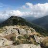
 Summit Ajusco Backcountry Route
5.8 mi 9.4 km • 2,586' Up 788.36 m Up • 2,607' Down 794.6 m Down

 Lomas d…, MX
 Parque de San Nicholas Totolapan y Ajusco
11.7 mi 18.8 km • 3,521' Up 1073.32 m Up • 3,523' Down 1073.74 m Down
San Miguel Mountain
15.5 mi 24.9 km • 2,646' Up 806.39 m Up • 2,645' Down 806.12 m Down
Lomas d…, MX
 Desierto de los Leones (ex Covent to Ermita San Miguel)
9.7 mi 15.5 km • 2,713' Up 826.81 m Up • 2,712' Down 826.63 m Down
San Lor…, MX
Parque Ecológico Cacalomacan "La Placa"
13.0 mi 21.0 km • 1,630' Up 496.93 m Up • 1,630' Down 496.74 m Down


0 Comments