Hiking Project Logo

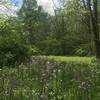
A great technical hike with lots of steep climbs and a peaceful solitude that feels like being in the wilderness.


Your Rating: Rating Rating Rating Rating Rating      Clear Rating
Your Difficulty:
Your Favorites: Add To-Do · Your List
Zoom in to see details
Map Key

2.2

Miles

3.5

KM

Loop

1,059' 323 m

High

850' 259 m

Low

436' 133 m

Up

427' 130 m

Down

8%

Avg Grade (4°)

37%

Max Grade (20°)

Dogs Leashed

Features Birding · Cave · Fall Colors · Lake · Spring · Views · Wildlife

Description

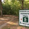
A very fun hike that features a few steep climbs that seem to last forever. There's also roots, rocks, and logs spread throughout the path that requires attentive footwork and focus. The park is close to town, but it also has a nice "middle of nowhere" feel. To keep on track with the navigating, keep to the right at each intersection as you follow this challenging trail.

For a counter-clockwise loop, turn right at the log cabin and start a gradual climb. Pretty soon the grade flattens and follows a slightly rolling cadence before the second climb. On the other side, a very technical singletrack descent leads hikers through a series of switchbacks to reach the bottom of the drainage.

This is followed by a long and steep climb that is peppered with switchbacks, logs, rocks, and tree roots to make things more challenging. The next section gives hikers a chance to recoup as the Alley Trail follows the top of a flat ridgeline for a third-of-a-mile. Up next is a short but steep descent that plunges down to a slow, steady climb through boulders and a very un-manicured section of narrow singletrack.

Continuing on, the trail descends past two small ponds before starting in on the final climb at the other side of the drainage. After cresting the low forested ridge, it's time for a mellow descent that travels past Lake Loretta to end on the park road.

Contacts

Shared By:

Ian Shafer

Trail Ratings

  4.5 from 11 votes

#6900

Overall
  4.5 from 11 votes
5 Star
64%
4 Star
18%
3 Star
18%
2 Star
0%
1 Star
0%
Trail Rankings

#121

in Ohio

#6,900

Overall
10 Views Last Month
952 Since Oct 17, 2016
Difficult Difficult

0%
0%
0%
50%
50%
0%

0 Comments

Weather


Current Trail Conditions

Unknown
Add Your Check-In

Check-Ins

Mar 8, 2021
Danielle Lloyd
Fun little trail, very steep in most areas. 2.2mi — 2h 30m
Nov 28, 2020
Rob Major
lost the trail at the disc golf course. followed Old Logan Rd back to the park entrance. 2.6mi — 1h 06m
Apr 27, 2018
Nathan Haughton
Apr 13, 2018
Nate Hyman
Jan 7, 2018
Kellie Gedert
Great trail with plenty of up and down hill. 2mi
Welcome

Join the Community

Create your FREE account today!
Already have an account? Login to close this notice.

Get Started