
 Continue with onX Maps
 Continue with Facebook


 Particularly Special Place


 Intermediate/Difficult
Intermediate/Difficult
Intermediate/Difficult
 Intermediate/Difficult
 House on Fire Ruins
2.0 mi 3.2 km • 52' Up 15.81 m Up • 52' Down 15.77 m Down

 Blanding, UT
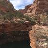
 Big Spring Canyon/Squaw Canyon Loop
7.4 mi 11.8 km • 541' Up 164.86 m Up • 541' Down 164.96 m Down
Moab, UT
Chesler Park Loop
10.5 mi 17.0 km • 1,347' Up 410.45 m Up • 1,369' Down 417.19 m Down
Monticello, UT
Fish and Owl Canyon Loop Route
17.1 mi 27.5 km • 1,992' Up 607.16 m Up • 1,995' Down 608.12 m Down
Blanding, UT
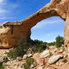
 Owachomo Bridge Out and Back
0.5 mi 0.8 km • 172' Up 52.46 m Up • 173' Down 52.61 m Down
Pictograph Fork Loop
8.6 mi 13.8 km • 1,062' Up 323.72 m Up • 1,060' Down 323.13 m Down


0 Comments