
 Continue with onX Maps
 Continue with Facebook


 Particularly Special Place


 Difficult
Difficult
Difficult
 Difficult
Land Manager: California State Parks - Henry W. Coe State Park
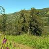
 Coyote Lake and Ridge Hike
6.8 mi 11.0 km • 797' Up 242.86 m Up • 797' Down 242.91 m Down

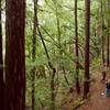
 Harvey Bear Ranch Hike
11.1 mi 17.8 km • 1,518' Up 462.57 m Up • 1,517' Down 462.45 m Down
 San Martin, CA
Merry-Go-Round to Sprig Trail Loop
San Martin, CA
Merry-Go-Round to Sprig Trail Loop
8.8 mi 14.2 km • 1,676' Up 510.98 m Up • 1,678' Down 511.54 m Down
Gilroy, CA
 Bald Mountain Out and Back
1.6 mi 2.5 km • 110' Up 33.57 m Up • 110' Down 33.54 m Down
Almaden…, CA
Mount Umunhum Summit and Back
8.3 mi 13.3 km • 1,195' Up 364.28 m Up • 1,195' Down 364.29 m Down
Almaden…, CA
Sierra Vista Preserve Loop
4.6 mi 7.4 km • 1,052' Up 320.5 m Up • 1,052' Down 320.66 m Down


1 Comment