Hiking Project Logo

A steep ascent through the open ridges and valleys to Matanuska Peak.


Your Rating: Rating Rating Rating Rating Rating      Clear Rating
Your Difficulty:
Your Favorites: Add To-Do · Your List
Zoom in to see details
Map Key

5.5

Miles

8.9

KM

Point to Point

5,902' 1,799 m

High

547' 167 m

Low

5,614' 1,711 m

Up

259' 79 m

Down

20%

Avg Grade (11°)

115%

Max Grade (49°)

Dogs Leashed

Features Birding · Fall Colors · River/Creek · Wildflowers · Wildlife

Description

Begin at the McRoberts Creek Trailhead and follow an access road until signs indicate the trail heading into the trees on the left. The trail is pretty well marked with plastic signs, and later cairns in the higher elevations. While the summit is quite captivating, the entire trail is beautiful and well worth admiring your surroundings at various points of your trip.

Due to some erosion in previous years, the trail has been rerouted to a slightly longer meander toward Lazy Mountain. This reroute eventually makes its way back to the original course. Here you'll find fireweed and ample blueberries if you time your visit to the right season.

Continue along the trail as it turns toward Matanuska Peak through a beautiful valley covered with low brush. The valley has a steady but slight grade that doesn't hinder progress. You'll eventually find a dilapidated picnic table that makes a great resting point before a small creek crossing.

Ahead, the climbing begins in earnest and the final mile to the top is very steep! Hikers will encounter some loose gravel during the climb that can be discouraging when it moves beneath one's feet. Fortunately, it doesn't last too long and more stable lichened-covered boulders are soon reached.

Once you've conquered the demanding steeps, you're sure to enjoy basking in the views of craggy ridges and lush valleys that stretch far into the distance.

Contacts

Shared By:

Ella Embree

Trail Ratings

  4.6 from 5 votes

#7395

Overall
  4.6 from 5 votes
5 Star
50%
4 Star
50%
3 Star
0%
2 Star
0%
1 Star
0%
Trail Rankings

#82

in Alaska

#7,395

Overall
5 Views Last Month
1,583 Since Sep 15, 2016
Difficult Difficult

0%
0%
0%
0%
60%
40%

Photos

4 miles from the start of the trail. 3500' of altitude.
Sep 29, 2020 near Lazy Mo…, AK
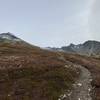
The main trail around the tree line altitude.
Sep 29, 2020 near Lazy Mo…, AK
In March, enjoy expansive, snow-covered views from just below the summit on Matanuska Peak.
Mar 16, 2017 near Lazy Mo…, AK
Looking toward the summit around 4,000' of elevation.
Sep 29, 2020 near Lazy Mo…, AK
Panorama from the Matanuska Peak summit facing southwest.
Mar 22, 2016 near Lazy Mo…, AK
Westward bound between Matanuska Peak and Lazy Mountain.
Mar 22, 2016 near Lazy Mo…, AK

0 Comments

Weather


Current Trail Conditions

Unknown
Add Your Check-In

Check-Ins

Jul 9, 2019
Pearl S
Welcome

Join the Community

Create your FREE account today!
Already have an account? Login to close this notice.

Get Started