
 Continue with onX Maps
 Continue with Facebook


 Particularly Special Place


 Intermediate
Intermediate
Intermediate
 Intermediate
 Bear Mountain
5.4 mi 8.7 km • 1,549' Up 472.12 m Up • 1,548' Down 471.96 m Down

 Salisbury, CT
CT State Highpoint/Tri-point Out and Back
Salisbury, CT
CT State Highpoint/Tri-point Out and Back
2.9 mi 4.7 km • 1,045' Up 318.64 m Up • 1,045' Down 318.48 m Down
 Brace Mountain Out-and-Back
3.9 mi 6.3 km • 1,445' Up 440.51 m Up • 1,445' Down 440.56 m Down
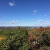
Rand's View Out and Back
5.4 mi 8.7 km • 1,110' Up 338.19 m Up • 1,107' Down 337.29 m Down
Canaan, CT
Sunset Rock
3.8 mi 6.1 km • 1,052' Up 320.51 m Up • 1,051' Down 320.32 m Down
Macedonia Ridge Trail
6.4 mi 10.3 km • 1,592' Up 485.14 m Up • 1,586' Down 483.51 m Down
Kent, CT


0 Comments