
 Continue with onX Maps
 Continue with Facebook


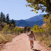
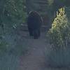
 Particularly Special Place


 Intermediate

 Intermediate
Land Manager: CO Parks & Wildlife - Mueller State Park
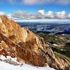
 Devils Playground to Pikes Peak Summit to Barr Trail
18.9 mi 30.4 km • 4,138' Up 1261.23 m Up • 7,397' Down 2254.62 m Down
 Rampart Reservoir Trail #700
11.1 mi 17.9 km • 403' Up 122.9 m Up • 407' Down 123.99 m Down
 Cascade…, CO
Hogback Ridge Summit via Quarry Pass
Cascade…, CO
Hogback Ridge Summit via Quarry Pass
4.1 mi 6.6 km • 518' Up 157.87 m Up • 521' Down 158.83 m Down
Manitou…, CO
The Red Rocks
3.7 mi 6.0 km • 522' Up 159.23 m Up • 519' Down 158.16 m Down
 Section 16/Palmer Loop
5.9 mi 9.6 km • 1,287' Up 392.19 m Up • 1,288' Down 392.48 m Down
Manitou…, CO
Heller Center to Pulpit Rock
2.2 mi 3.5 km • 252' Up 76.83 m Up • 251' Down 76.52 m Down
Colorad…, CO


1 Comment