Hiking Project Logo

North Forest Trail

Easy
 3.0 (1)

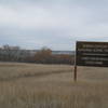
A pleasant, flat trail that winds around the edge of, and leads through, a forested area.


Your Rating:      Clear Rating
Your Difficulty:
Your Favorites: Add To-Do · Your List
Zoom in to see details
Map Key

2.0

Miles

3.3

KM

Point to Point

1,722' 525 m

High

1,688' 514 m

Low

75' 23 m

Up

54' 17 m

Down

1%

Avg Grade (1°)

7%

Max Grade (4°)

Dogs Leashed

Features Birding · Fall Colors · Wildlife

Open from sun up to sun down daily. Pets are allowed on trails but must be on a leash no longer than six feet in length.

Description

Those unfamiliar with the area often have difficulty finding the trailhead as it is located several miles from the Knife River Indian Villages Visitor Center. From the visitor center, continue north on State Highway 37 for 2.2 miles. Turn east, right, just after crossing the Knife River, onto County Road 18. Continue east 0.6 mile, then turn north, left, into the trailhead parking lot.

The trail loops through the historic homeland of the Hidatsa. It follows the edge of a forested area before making its way near the Missouri River, and then looping back through the forest. It is not particularly well signed, but it is usually well mowed and one follows the wide, mown path. This trail is good for birding and connects to other trails to accommodate a much longer outing.

Flora & Fauna

White-tailed deer and a variety of birds.

Contacts

Shared By:

Karen Ryberg

Trail Ratings

  3.0 from 1 vote

#33520

Overall
  3.0 from 1 vote
5 Star
0%
4 Star
0%
3 Star
100%
2 Star
0%
1 Star
0%
Trail Rankings

#88

in North Dakota

#33,520

Overall
2 Views Last Month
126 Since Apr 24, 2016
Easy

100%
0%
0%
0%
0%
0%

0 Comments

Weather


Current Trail Conditions

Unknown
Add Your Check-In

Check-Ins

Apr 18, 2015
Karen Ryberg
enjoyable