
 Continue with onX Maps
 Continue with Facebook


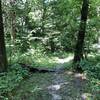
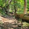
 Particularly Special Place


 Difficult
Difficult
Difficult
 Difficult
 Rozarks Loop
1.0 mi 1.7 km • 100' Up 30.38 m Up • 100' Down 30.46 m Down
 Outer Loop (Blue)
5.2 mi 8.3 km • 462' Up 140.68 m Up • 464' Down 141.47 m Down
 Prairie Center Main Trail
2.7 mi 4.3 km • 172' Up 52.43 m Up • 175' Down 53.22 m Down
 Olathe, KS
 Wudchuck Run (Phases 7 & 8)
5.2 mi 8.3 km • 532' Up 162.17 m Up • 532' Down 162.17 m Down
Rocky Point Glade
2.3 mi 3.7 km • 190' Up 57.94 m Up • 190' Down 57.79 m Down
Raytown, MO
Augie PH3 Half Loop
3.2 mi 5.2 km • 269' Up 82.03 m Up • 268' Down 81.75 m Down
Blue Sp…, MO


1 Comment