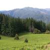
The Panther Ridge Trail follows along Panther Ridge from Bald Knob to Buck Point. This route is an old Native American travel corridor. Approximately 95% of this trail is within the Wild Rogue Wilderness, and is closed to motor vehicles.
The trail has no water, so hikers should carry enough water along with them. Most of the trail travels through rhododendron and scrub oak undergrowth and under magnificent stands of old-growth timber.
Panther Ridge Trail #1253 is in very good shape until a little under halfway to the Clay Hill Tr 1160A.
At 42° 43' 21.492" N, 123° 57' 9.438" W, all maintenance ends. Over the next ca. 2K, the Rhododendrons have made the trail nearly invisible and they're hiding numerous small logs. In some areas, the brush was nearly shoulder high. After that section, the trail is again in very good shape to the intersection with the Clay Ridge Trail #1160A.
Past the intersection with the Clay Ridge Trail 1160A, the Panther Ridge Trail continues to the Bald Knob Trailhead, but soon after starting that section, the trail is crossed by numerous small fallen trees. After about 3K, the trail disappears.
Starting at the Bald Knob Trailhead, the first ca. 1.8K of the trail has been cleared so well that it's like a city park. Unfortunately, the condition abruptly worsens at 42° 41' 8.832" N, 124° 1' 19.24" W where a tree has fallen on the trail markers.
Beyond that point, the trail disappears into tangled brush and numerous unrelated trails. The Panther Ridge Trail could not be found beyond 42° 41' 6.84" N, 124° 0' 52.16" W.
0 Comments