
 Continue with onX Maps
 Continue with Facebook


 Particularly Special Place


 Intermediate
Intermediate
Intermediate
 Intermediate
Land Manager: PA DCNR - Main Office
 Sunset Rocks Loop Hike
7.5 mi 12.1 km • 1,009' Up 307.46 m Up • 1,009' Down 307.58 m Down


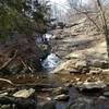
 Cunningham Falls Out-and-Back
1.2 mi 2.0 km • 142' Up 43.4 m Up • 142' Down 43.29 m Down
Wolf Rock / Chimney Rock Loop
3.6 mi 5.7 km • 710' Up 216.46 m Up • 734' Down 223.87 m Down
Scenic Vista Loop
3.7 mi 5.9 km • 596' Up 181.52 m Up • 597' Down 181.93 m Down
 Appalachian Trail: Wolfsville Road to Pen Mar Park
9.8 mi 15.7 km • 1,795' Up 547.12 m Up • 1,965' Down 598.94 m Down
Mid State Trail (MST)
325.1 mi 523.2 km • 45,161' Up 13765 m Up • 44,599' Down 13593.7 m Down
Bedford, PA


0 Comments