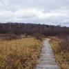
Land Manager: PA DCNR - Moshannon State Forest
 Black Moshannon State Park Loop
13.3 mi 21.4 km • 517' Up 157.65 m Up • 518' Down 157.99 m Down


 Troy, PA
 Musser/Shingletown Loop
7.7 mi 12.5 km • 1,361' Up 414.91 m Up • 1,367' Down 416.61 m Down


 State C…, PA
 Jackson Trail - Mid State Trail Loop
6.2 mi 10.0 km • 802' Up 244.38 m Up • 845' Down 257.65 m Down


 Pine Gr…, PA
 Shingletown Loop
7.0 mi 11.3 km • 785' Up 239.25 m Up • 785' Down 239.39 m Down


 Boalsburg, PA
 Coopers Gap Loop
4.2 mi 6.7 km • 406' Up 123.6 m Up • 405' Down 123.53 m Down


 Church…, PA
 Mid State Trail (MST)
325.1 mi 523.2 km • 45,161' Up 13765 m Up • 44,599' Down 13593.7 m Down


 Bedford, PA


0 Comments