
 Continue with onX Maps
 Continue with Facebook


 Particularly Special Place


 Intermediate
Intermediate
Intermediate
 Intermediate
Land Manager: NPS - Yosemite
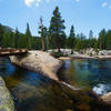
 Tuolumne Meadows to Elizabeth Lake: Out-N-Back
8.1 mi 13.0 km • 1,023' Up 311.76 m Up • 1,023' Down 311.79 m Down

 Yosemit…, CA
 Grand Canyon of the Tuolumne to White Wolf
29.8 mi 47.9 km • 4,681' Up 1426.72 m Up • 5,407' Down 1647.92 m Down
 Sunrise to Happy Isles via Clouds Rest and Half Dome
20.0 mi 32.2 km • 4,111' Up 1253.07 m Up • 8,216' Down 2504.21 m Down
Yosemit…, CA
High Sierra Camp: May Lake- Glen Aulin- Tuolumne Meadows
19.8 mi 31.9 km • 2,547' Up 776.45 m Up • 2,003' Down 610.49 m Down
Yosemit…, CA
 Green Creek Trail to East Lake Out-and-Back
8.2 mi 13.2 km • 1,454' Up 443.31 m Up • 1,454' Down 443.32 m Down
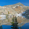
Rutherford and Anne Lakes
1.1 mi 1.8 km • 257' Up 78.21 m Up • 274' Down 83.61 m Down


0 Comments