
 Continue with onX Maps
 Continue with Facebook


 Particularly Special Place


 Difficult
Difficult
Difficult
 Difficult
Local Club: Yellowstone Association
Land Manager: National Park Service - Yellowstone National Park
 Bighorn Pass
20.1 mi 32.3 km • 1,950' Up 594.24 m Up • 2,022' Down 616.4 m Down

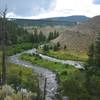
 Lava Creek Trail
4.7 mi 7.6 km • 218' Up 66.47 m Up • 844' Down 257.23 m Down
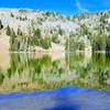
 Sky Rim - East
17.6 mi 28.3 km • 3,261' Up 993.89 m Up • 3,338' Down 1017.27 m Down
Gardiner, MT
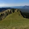
Sky Rim - West
19.4 mi 31.3 km • 4,313' Up 1314.66 m Up • 4,313' Down 1314.57 m Down
Gardiner, MT
Mount Washburn
7.3 mi 11.7 km • 1,384' Up 421.81 m Up • 1,383' Down 421.56 m Down
 Canyon…, WY
West Fork Mill Creek Loop
Canyon…, WY
West Fork Mill Creek Loop
25.3 mi 40.7 km • 4,673' Up 1424.43 m Up • 4,669' Down 1423.03 m Down
Gardiner, MT


0 Comments