Hiking Project Logo

A horse trail that fords Bacon Rind Creek, Gallatin River, and Fan Creek and joins Fawn Pass Trail.


Your Rating: Rating Rating Rating Rating Rating      Clear Rating
Your Difficulty:
Your Favorites: Add To-Do · Your List
Zoom in to see details
Map Key

1.4

Miles

2.2

KM

Point to Point

7,188' 2,191 m

High

7,100' 2,164 m

Low

93' 28 m

Up

24' 7 m

Down

2%

Avg Grade (1°)

4%

Max Grade (2°)

Dogs No Dogs

Features River/Creek

Description

This spur trail primarily used by horse parties starts from the Bacon Rind Trailhead on a small gravel road on the west side of U.S. Highway 191, north of West Yellowstone. It fords more creeks and rivers per mile than any trail in Yellowstone.

From the large parking area, the trail crosses Bacon Rind Creek and then Highway 191. It then fords the Gallatin River just below its confluence with Fan Creek. The trail continues along Fan Creek .3 miles and fords it as well, before joining the main Fawn Pass Trail at the 1.4-mile mark.

Hikers can avoid all these fords by starting at the main Fawn Pass Trailhead.

Thanks to guidebook author, Tom Carter, for sharing this trail description. To learn more about visiting Yellowstone, check out his book, Day Hiking Yellowstone.

Contacts

Shared By:

Tom Carter

Trail Ratings

  1.0 from 1 vote

#49401

Overall
  1.0 from 1 vote
5 Star
0%
4 Star
0%
3 Star
0%
2 Star
0%
1 Star
100%
Trail Rankings

#844

in Wyoming

#49,401

Overall
2 Views Last Month
155 Since Sep 9, 2015
Intermediate Intermediate

0%
0%
100%
0%
0%
0%

Photos

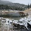
Beaver Dam on the Gallatin with permission from John Christopher Copyright JChristopherGalleries.com
Apr 19, 2016 near West Ye…, MT

0 Comments

Weather


Current Trail Conditions

Unknown
Add Your Check-In

Check-Ins

none
Welcome

Join the Community! It's FREE

Already have an account? Login to close this notice.