Hiking Project Logo

A steep, sustained ascent to the south ridge of Mt. Ogden.


Your Rating: Rating Rating Rating Rating Rating      Clear Rating
Your Difficulty:
Your Favorites: Add To-Do · Your List
Zoom in to see details
Map Key

5.6

Miles

9.1

KM

Point to Point

9,236' 2,815 m

High

5,131' 1,564 m

Low

4,193' 1,278 m

Up

88' 27 m

Down

14%

Avg Grade (8°)

44%

Max Grade (24°)

Dogs Unknown

Features Birding · Fall Colors · River/Creek · Views · Wildflowers · Wildlife

This trail is open to the snowline.

Description

The trail begins with a moderate two-mile hike which changes into a steep, difficult climb from the foothills east of Ogden to the ridge south of Mount Ogden.

The trail leaves the parking lot towards the mountain. This lower part of the trail climbs to the mouth of Beus Canyon where it intersects with the Bonneville Shoreline Trail going north to Weber State University. The trail continues along Beus Creek until it reaches a small meadow where the canyon forks. This meadow is locally known as Fern Valley for obvious reasons.

The trail continues on the south fork of the stream until it begins the steep climb to the ridge between Beus Canyon and Birch Canyon to the south. It stays in the dry, hot oak brush hillsides until it reaches timberline.

Then the trail goes north into the head of Beus Creek. Piles of rock, commonly called rock cairns, mark a route to the saddle south of Mount Ogden with its prominent radio tower. At this saddle you can follow the summer access road into Snowbasin Resort Area.
If you enjoy spectacular views, this is the hike for you.

The area has outstanding geologic formations and a bounty of wildflowers throughout the spring and summer season. The trail is near the head of both Malans Basin and Taylor Canyon when it reaches Mount Ogden. Taylor Canyon is the first canyon south of Ogden Canyon so named for John Taylor who built a lime kiln at its mouth. The lower portion of both canyons is privately owned as well as very difficult terrain and we don't recommend you enter either of these canyons.

Contacts

Shared By:

Brian Smith

Trail Ratings

  3.3 from 6 votes

#24963

Overall
  3.3 from 6 votes
5 Star
17%
4 Star
33%
3 Star
33%
2 Star
0%
1 Star
17%
Trail Rankings

#760

in Utah

#24,963

Overall
12 Views Last Month
1,888 Since Aug 5, 2015
Difficult Difficult

0%
0%
13%
13%
75%
0%

Photos

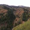
Looking up to the summit of Mt Ogden from the Beus Canyon Trail.
Jun 10, 2017 near South O…, UT

0 Comments

Weather


Current Trail Conditions

Unknown
Add Your Check-In

Check-Ins

Sep 5, 2022
D Guthrie
Short out and back for the holiday. 5mi — 2h 20m
Jun 22, 2019
Nathaniel Gilbert
Aug 1, 2018
Michael Alexander
Apr 29, 2018
Spencer Baker
2mi
Apr 29, 2018
Matthew Martin
Exposed side of the mountain gets very hot. The plants are already growing into the trail so wear long pants on a cooler day. 3.5mi
Oct 22, 2017
Michael C Salansky
4mi
Jul 29, 2017
Mackenzie Olsen
Welcome

Join the Community! It's FREE

Already have an account? Login to close this notice.