
 Continue with onX Maps
 Continue with Facebook


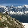
 Particularly Special Place


 Intermediate

 Intermediate
 Boucle Vallorcine - Vallon de Berard - Refuge de la Loriaz
8.5 mi 13.6 km • 2,772' Up 844.97 m Up • 2,762' Down 841.95 m Down
Chamoni…, FR
 Aiguillette des Posettes
3.6 mi 5.8 km • 2,460' Up 749.93 m Up • 771' Down 235.12 m Down
Chamoni…, FR
Tre-le-Champ to Flegere
4.2 mi 6.8 km • 2,415' Up 736.14 m Up • 887' Down 270.33 m Down
 Chamoni…, FR
Tour du Mont Blanc
Chamoni…, FR
Tour du Mont Blanc
105.7 mi 170.2 km • 31,302' Up 9540.81 m Up • 31,300' Down 9540.27 m Down
Martign…, CH
 Index Chairlift to Lac Blanc to Flégère Gondola
6.3 mi 10.2 km • 1,202' Up 366.45 m Up • 2,907' Down 886.09 m Down
Nant Bordon Suspension Bridge and Lac Vert Loop
4.7 mi 7.5 km • 1,046' Up 318.91 m Up • 1,008' Down 307.14 m Down


0 Comments