Dogs Off-leash

Features
Birding · Commonly Backpacked · Fall Colors · River/Creek · Spring · Views · Waterfall · Wildflowers · Wildlife
Family Friendly
Teens or boot families (experienced hikers) would enjoy this trail. Probably best doing it in two days.

Camping is permitted at undeveloped sites along parts of this trail. Camping is recommended 300' away from any trail or stream. Use no-impact camping techniques. Campfire permits are not required, but please be sure your fire is dead out before you leave. Pack it in / Pack it out.
No ATVs. Motorcycles are allowed on parts of trail, so motorcycles and hikers need to be considerate of each other.
Permits are required to remove firewood, rocks and minerals, transplants and decorative wood.
Overview
Need to Know
Drinking water is not readily available. Water from streams should be treated before use. Hikers are advised to carry an adequate supply.
Some very steep, loose areas.
Description
This is an ambitious day hike for a body blitz, or divide this into two gratifying shorter day hikes. Camping is allowed along most of the trail.
Park at
High Drive and
Gold Camp Rd. Head down
Gold Camp Rd. to the
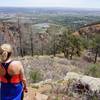
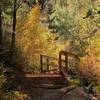
7 Bridges Trail (#622). Enjoy the easygoing path along the creek and across the beautifully crafted bridges. After the 7th bridge, comes a small scramble up to a scree field with some fantastic views of Kineo Mountain, as well as down into the channel of North Cheyenne Creek.
From the end of
7 Bridges Trail (#622), the
Pipeline Trail (#668) will continue along the ridgeline for a stretch then cross North Cheyenne Creek.
From here, the wildflower-lined path is an easy ramble along and across the creek. After several stream pass overs, the trail steepens and the climb becomes more demanding, but the splendor of the cascades of the creek make the incline seem less strenuous. At long last, the final passage of the trail travels through the forest until it meets
Foresters Trail (#701).
Take
Foresters Trail (#701) to the left. This portion of
Foresters Trail (#701) is a relatively uneventful doubletrack. After about .33 miles,
Foresters Trail (#701) ends at the junction of
FSR 379. Hike from
Foresters Trail (#701) and to the left several feet along
FSR 379 (small parking area) and find the trailhead for
Nelson's Trail (#672).
Foresters Trail (#701) connects to
Nelson's Trail (#672) .
Nelson's Trail (#672) is densely forested, but heavy with roots, rocks and ruts. The incline is steep and rises relatively quick. This is an advanced trail with very little water resources.
At about 1.3 mi on
Nelson's Trail (#672) is the trailhead for
Mount Rosa (#673).
Mount Rosa (#673) heads up to the summit of Mount Rosa (11499 ft.).
Mount Rosa (#673) is an outstanding out and back with great views.
After summiting Mount Rosa, continue down
Nelson's Trail (#672) toward FSR 381. Upon reaching FSR 381, head to the right to find the
St. Mary Falls Trail (#624). This trailhead is unmarked, so look for the fencing on the left side of the open area.
Once on
St. Mary Falls Trail (#624), you'll start to descend quickly until you reach a flowing spring. This is a good water resource if in need. Please filter! After crossing the spring, the trail evens out for about a mile along the ridgeline. Again, the trail will have a steep slope toward the falls.
Upon reaching the signpost, take
St. Mary Falls Spur Trail out to St. Mary Falls. This is a great photo op or place to rest. From the falls, the trail descends gradually and is a moderate ramble alongside Buffalo Canyon Creek to
Gold Camp Rd. and the parking lot.
Flora & Fauna
Columbines, primrose, yarrow, Indian paintbrush, Aspen stands, mixed pine, grasses. Birds and snakes.
History & Background
Frank Nelson (1857 -1944) came to Colorado from Denmark in 1906 and is widely credited with having built the
7 Bridges Trail (#622) in (1906). Nelson prospected while operating Nelson's Resorts (Nelson Camp) from 1906-1931. Tourists would travel from the Gold Camp Road to several resort cabins along what is currently the
Pipeline Trail (#668). Remains from the cabins as well as various nails, cans, and metal items are still present as of 2013.
Rose Georgina Kingsley was an early British settler of Colorado Springs. Rose was an author, teacher, avid botanist, hiker and mountain climber. While hiking and collecting flora in the area, she became cordial with the survey crew of Dr. Ferdinand V. Hayden. During this time, she became the first lady to climb to the summit of Monte Rosa, which was named in her honor by the crew. (Women Rewriting Boundaries: Victorian Women Travel Writers)
Contacts
Shared By:
K Keiter
with improvements
by Edward Potereiko

 Continue with onX Maps
 Continue with Facebook


 Particularly Special Place


 Difficult

 4.4 (29)


 Bad / Closed


3 Comments