Hiking Project Logo

Shelltowee Trace section through the Clifty Wilderness.


Your Rating: Rating Rating Rating Rating Rating      Clear Rating
Your Difficulty:
Your Favorites: Add To-Do · Your List
Zoom in to see details
Map Key

9.0

Miles

14.4

KM

Point to Point

1,239' 378 m

High

760' 232 m

Low

1,415' 431 m

Up

953' 290 m

Down

5%

Avg Grade (3°)

20%

Max Grade (11°)

Dogs Leashed

Features Fall Colors · River/Creek · Swimming · Views · Waterfall · Wildflowers · Wildlife

Wilderness Area, no power vehicles or equipment allowed.

Description

This is a section of the 300-mile Sheltowee Trace Trail through the Clifty Wilderness Area. This 12,646-acre area has more than 20 miles of trail that take hikers through stream valleys with dense hemlock forest and across ridges with spectacular landscape views. The terrain is rugged and steep, offering plenty of physical challenges and adventures.

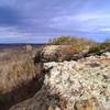
This is a rugged section along sandstone cliffs, but it offers views of a large number of rock formations, including the Indian Staircase. Before heading out, understand that this is a Federally Designated Wilderness Area which means that there are no facilities or roads and cell service may be non-existent. If you get in trouble, you may be on your own. The reward, however, is a remote and less populated area to explore.

For more information visit the Forest Service website or the Sheltowee Trace Trail website.

Flora & Fauna

Clifty Wilderness supports an unusual array of flora with 750 flowering plants and 170 species of moss that thrive in the area. This diversity is attributed to geographic location, topography and glacial history. Some plant and animal species in this area are listed as endangered, threatened, sensitive or rare.

Contacts

Shared By:

Mike Embry

Trail Ratings

  4.5 from 8 votes

#7200

Overall
  4.5 from 8 votes
5 Star
63%
4 Star
25%
3 Star
13%
2 Star
0%
1 Star
0%
Trail Rankings

#69

in Kentucky

#7,200

Overall
28 Views Last Month
4,206 Since May 29, 2015
Intermediate/Difficult Intermediate/Difficult

0%
0%
50%
0%
50%
0%

Photos

Indian Arch poses for a dramatic photo along the Sheltowee Trace.
Jan 18, 2017 near Frenchburg, KY
Suspension bridge over the Red River.
Jan 18, 2017 near Frenchburg, KY
A large boulder rests beside the trail.
Jan 18, 2017 near Frenchburg, KY
Sheltowee Trace crosses Salt Fork Creek. Watch your step.
Jan 18, 2017 near Frenchburg, KY
Wolf tracks dot the snow on the Sheltowee Trace Trail.
Jan 18, 2017 near Frenchburg, KY
This trail sees fresh, untracked snow, if you don't count the wolves.
Jan 18, 2017 near Frenchburg, KY

0 Comments

Weather


Current Trail Conditions

Unknown
Add Your Check-In

Check-Ins

Join the Community

Create your FREE account today!
Already have an account? Login to close this notice.

Get Started.