
 Continue with onX Maps
 Continue with Facebook


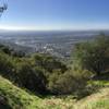
 Particularly Special Place


 Easy/Intermediate

 Easy/Intermediate
Land Manager: City of Glendora, CA - Parks & Recreation
 Mt. Bliss from Monrovia Canyon Park
13.5 mi 21.8 km • 2,804' Up 854.79 m Up • 2,803' Down 854.39 m Down
 Mount Wilson
13.6 mi 21.9 km • 4,739' Up 1444.47 m Up • 4,739' Down 1444.32 m Down
Sierra…, CA
 Mt. Zion Loop
9.3 mi 14.9 km • 2,232' Up 680.18 m Up • 2,189' Down 667.06 m Down
Sierra…, CA
Chantry Flat/Mt. Wilson Loop
15.3 mi 24.6 km • 4,195' Up 1278.55 m Up • 4,183' Down 1274.84 m Down
Sierra…, CA
 Henninger Flats
6.1 mi 9.9 km • 1,550' Up 472.46 m Up • 1,550' Down 472.4 m Down
 OCTA 30k
19.7 mi 31.6 km • 1,179' Up 359.5 m Up • 1,476' Down 450.01 m Down


0 Comments