Hiking Project Logo

A beautiful foothills trail in the South Valley Park through a meadow that sits overlooking red rock formations.


Your Rating: Rating Rating Rating Rating Rating      Clear Rating
Your Difficulty:
Your Favorites: Add To-Do · Your List
Zoom in to see details
Map Key

2.6

Miles

4.1

KM

Point to Point

6,107' 1,861 m

High

5,839' 1,780 m

Low

281' 86 m

Up

194' 59 m

Down

3%

Avg Grade (2°)

9%

Max Grade (5°)

Dogs Leashed

Features Birding · Views · Wildlife

Description

This is an easy and enjoyable loop through a meadow which sits slightly above the rest of the valley, affording great views along the trail of the surrounding foothills and red rock formations. The elevation change is long and gradual adding a slight challenge to the first half of the loop until the decline begins. As the name alludes to, there are plenty of opportunities for elk and deer sightings since the wide open meadows are a favorite place of theirs. Go early in the morning or at dusk, and you're likely to run into them before they hop out of the way off the trail.

The hike begins where the Grazing Elk Trail intersects Valley Rd on its southern side. The nearest parking lot is just east of the Valley Rd and Deer Creek Canyon Rd intersection located at approximately 39.551164" N, -105.139235" W. From there you may reach the start by heading west on Deer Creek Canyon Rd and taking a right onto Valley Rd using the small shoulder until you reach the trail crosswalk. Otherwise, you can also choose the more scenic (and probably safer) route taking the Coyote Song Trail from the parking lot keeping left onto the Swallow Trail and finally reaching the Grazing Elk Trail which takes you to the Valley Rd crosswalk where the ruoute begins. The latter route to the hike start from the parking lot is about 1 mile - a nice extension to your hike or a great warm up/ cool down through the valley's red rocks.

Flora & Fauna

Elk, deer, and hawks.

Contacts

Shared By:

Scott Tuttle

Trail Ratings

  3.1 from 13 votes

#24346

Overall
  3.1 from 13 votes
5 Star
0%
4 Star
23%
3 Star
62%
2 Star
15%
1 Star
0%
Trail Rankings

#1,956

in Colorado

#24,346

Overall
5 Views Last Month
1,193 Since May 6, 2015
Easy/Intermediate Easy/Intermediate

60%
20%
20%
0%
0%
0%

Photos

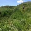
This is one of the farthest points of the trail from South Valley Rd. This is looking toward C-470.
Aug 4, 2019 near Ken Caryl, CO

0 Comments

Weather


Current Trail Conditions

Unknown
Add Your Check-In

Check-Ins

May 27, 2022
Rachel Solorio
2.6mi
Jan 17, 2022
Matt Culpepper
Via Rattlesnake Gulch Trl from Deer Creek Canyon Drive TH counter-clockwise (3/300) 3mi — 2h 00m
Jun 28, 2021
Rachel Franck
2.6mi
Apr 2, 2021
Austin Goodin
Jan 11, 2021
Gina G
May 13, 2020
Nick Bennett
3mi
Apr 20, 2020
Matt Kohn
Mar 26, 2020
Rachel Solorio
2.6mi
Welcome

Join the Community

Create your FREE account today!
Already have an account? Login to close this notice.

Get Started