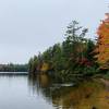
 Horseshoe Lake to Low's Ridge
6.7 mi 10.7 km • 425' Up 129.66 m Up • 425' Down 129.67 m Down


 Tupper…, NY
 Cat Mountain Out-and-Back
4.9 mi 7.9 km • 825' Up 251.57 m Up • 827' Down 252.01 m Down


 Tupper…, NY
 Deer Pond Out-and-Back
4.4 mi 7.0 km • 578' Up 176.08 m Up • 578' Down 176.05 m Down


 Tupper…, NY
 Floodwood Loop Trail
7.2 mi 11.6 km • 208' Up 63.4 m Up • 219' Down 66.76 m Down


 Tupper…, NY
 NPT (Northville-Placid Trail)
141.2 mi 227.3 km • 12,875' Up 3924.39 m Up • 12,070' Down 3678.84 m Down


 Northville, NY


0 Comments