
 Continue with onX Maps
 Continue with Facebook


 Particularly Special Place


 Intermediate
Intermediate
Intermediate
 Intermediate
Land Manager: USFS - Gallatin National Forest Office
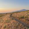
 Painted Hills Trail (and Connector Trail)
4.2 mi 6.7 km • 635' Up 193.58 m Up • 184' Down 56.23 m Down

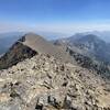
 Sacagawea Peak
4.2 mi 6.8 km • 1,794' Up 546.91 m Up • 1,793' Down 546.43 m Down
 Bozeman, MT
The Hyalite Crusher
Bozeman, MT
The Hyalite Crusher
20.0 mi 32.2 km • 5,077' Up 1547.59 m Up • 5,114' Down 1558.64 m Down
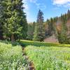
 Palisade Falls
1.2 mi 2.0 km • 227' Up 69.15 m Up • 227' Down 69.1 m Down
Bozeman, MT
Emerald and Heather Lakes
11.3 mi 18.3 km • 2,131' Up 649.57 m Up • 2,131' Down 649.54 m Down
Bozeman, MT
West Pine Creek
12.2 mi 19.6 km • 2,560' Up 780.37 m Up • 2,560' Down 780.22 m Down
Livingston, MT


0 Comments