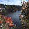
Land Manager: Mohonk Preserve
 Minnewaska Lake Carriageway
1.6 mi 2.6 km • 176' Up 53.54 m Up • 199' Down 60.76 m Down


 Kerhonkson, NY
 Bonticou Crag Route
2.3 mi 3.7 km • 412' Up 125.51 m Up • 426' Down 129.71 m Down


 Stone R…, NY
 Illinois Mountain
5.6 mi 9.0 km • 1,004' Up 306.02 m Up • 527' Down 160.67 m Down


 Highland, NY
 West Approach of Slide Mountain
5.5 mi 8.8 km • 1,712' Up 521.88 m Up • 1,712' Down 521.76 m Down


 Shokan, NY
 Breakneck Ridge Bypass
2.8 mi 4.5 km • 1,129' Up 344.21 m Up • 1,135' Down 346.08 m Down


 Cornwal…, NY
 Storm King Mountain
2.4 mi 3.9 km • 455' Up 138.62 m Up • 460' Down 140.21 m Down


 Cornwal…, NY


0 Comments