
 Continue with onX Maps
 Continue with Facebook


 Particularly Special Place


 Intermediate/Difficult

 Intermediate/Difficult
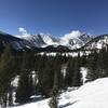
 Mount Blue Sky Out-and-Back
5.6 mi 8.9 km • 1,814' Up 552.85 m Up • 1,815' Down 553.16 m Down
Georgetown, CO
Beartrack Lakes Loop
12.2 mi 19.6 km • 2,381' Up 725.62 m Up • 2,388' Down 727.84 m Down
 Idaho S…, CO
 Loch Lomond (#701.1)
4.7 mi 7.6 km • 870' Up 265.12 m Up • 870' Down 265.15 m Down
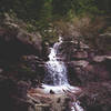
Maxwell Falls Loop
4.6 mi 7.4 km • 884' Up 269.38 m Up • 883' Down 269.13 m Down
 Grizzly Peak
5.6 mi 9.0 km • 2,381' Up 725.84 m Up • 2,379' Down 725.22 m Down
Keystone, CO
Kenosha Pass Out-and-Back
12.1 mi 19.5 km • 1,531' Up 466.51 m Up • 1,530' Down 466.44 m Down
Jefferson, CO


0 Comments