Continue with onX Maps
 Continue with Facebook


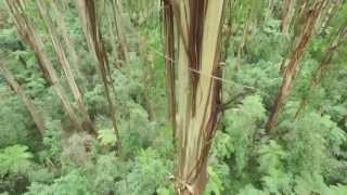
 Particularly Special Place


Recommended Routes in Dandenong Ranges National Park - 5
Hiking Project is built by hikers like you. Add Your Recommended Routes


 Intermediate
Sassafras to Emerald Walking Track
11.7 mi 18.8 km • 633' Up 193.02 m Up • 1,166' Down 355.35 m Down
 Olinda, AU

 Intermediate/Difficult
Kokoda Track (1000 Steps Walk)
2.4 mi 3.8 km • 939' Up 286.09 m Up • 937' Down 285.71 m Down
 Ferny C…, AU

 Difficult
Kalorama-Doongalla Loop
7.1 mi 11.4 km • 1,405' Up 428.27 m Up • 1,338' Down 407.74 m Down
Kalorama, AU


Dandenong Ranges National Park Hiking
- 45 Miles 72 Kilometers of Trail
- 5 Recommended Routes
- 3
Easy Trails

- 29
Intermediate Trails

- 8
Difficult Trails

Hiking Project is built by hikers like you. Share
what you know about this area!
Weather Averages
|
High
|
Low
|
Precip
|
Days w/
|
| J | F | M | A | M | J | J | A | S | O | N | D |
Trails in Dandenong Ranges National Park - 35
Hiking Project is built by hikers like you. Add Your Trails
|
1.3
mi
2.0
km
#1Zig Zag Track
Difficult
Olinda, AU
|
Difficult
|
Olinda, AU |
1
|
|
|
0.4
mi
0.6
km
#21000 Steps Track
Intermediate
Ferny Creek, AU
|
Intermediate
|
Ferny Creek, AU |
1
|
|
|
0.5
mi
0.9
km
#3Cascade Track
Intermediate
Mount Dandenong, AU
|
Intermediate
|
Mount Dandenong, AU |
1
|
|
|
0.9
mi
1.5
km
#4Eagles Nest Road
Intermediate
Mount Dandenong, AU
|
Intermediate
|
Mount Dandenong, AU |
1
|
|
|
1.4
mi
2.2
km
#5Fireline Track
Intermediate
Kalorama, AU
|
Intermediate
|
Kalorama, AU |
2
|
|
|
1.0
mi
1.5
km
#6Lyrebird Track
Intermediate
Ferny Creek, AU
|
Intermediate
|
Ferny Creek, AU |
3
|
|
1.5
mi
2.4
km
#7Coles Ridge Track
 Easy/Intermediate
Belgrave, AU
|
Easy/Intermediate
|
Belgrave, AU |
1
|
|
|
1.4
mi
2.2
km
#8Kyeema Track
Intermediate
Mount Dandenong, AU
|
Intermediate
|
Mount Dandenong, AU |
1
|
|
|
4.0
mi
6.4
km
#9Monbulk-Emerald Track
Intermediate
Monbulk, AU
|
Intermediate
|
Monbulk, AU |
1
|
|
|
1.1
mi
1.7
km
#10Paddy Track
Difficult
Selby, AU
|
Difficult
|
Selby, AU |
1
|
Photos of Dandenong Ranges National Park - 10
Hiking Project is built by hikers like you. Add Your Photos