Continue with onX Maps
 Sign in with Facebook


 Particularly Special Place


North Side
 KY
KY- …Central Kentucky
- Mammoth Cave National Park
- North Side


Recommended Routes in North Side - 3
Hiking Project is built by hikers like you. Add Your Recommended Routes


North Side Hiking
- 58 Miles 93 Kilometers of Trail
- 3 Recommended Routes
- 12
Easy Trails

- 20
Intermediate Trails

- 0
Difficult Trails

Hiking Project is built by hikers like you. Share
what you know about this area!
Weather Averages
|
High
|
Low
|
Precip
|
Days w/
|
| J | F | M | A | M | J | J | A | S | O | N | D |
Trails in North Side - 29
Hiking Project is built by hikers like you. Add Your Trails
0.6
mi
1.0
km
#1Bluffs Campsite Access Trail
 Intermediate/Difficult
Brownsville, KY


|
Intermediate/Difficult
|
Brownsville, KY |
7
|
|
2.8
mi
4.6
km
#2Mill Branch Trail
 Intermediate
Brownsville, KY
|
Intermediate
|
Brownsville, KY |
1
|
|
|
2.5
mi
4.1
km
#3South Loop
Intermediate
Brownsville, KY
|
Intermediate
|
Brownsville, KY |
1
|
|
|
5.7
mi
9.1
km
#4Raymer Hollow Trail
Intermediate
Brownsville, KY
|
Intermediate
|
Brownsville, KY |
4
|
|
|
4.4
mi
7.1
km
#5Buffalo Creek Trail
Intermediate
Brownsville, KY
|
Intermediate
|
Brownsville, KY |
5
|
|
|
8.4
mi
13.5
km
#6Sal Hollow Trail
Intermediate
Brownsville, KY
|
Intermediate
|
Brownsville, KY |
6
|
|
|
3.9
mi
6.3
km
#7Collie Ridge Trail
Intermediate
Brownsville, KY
|
Intermediate
|
Brownsville, KY |
3
|
|
|
4.9
mi
8.0
km
#8Big Hollow Trail North Loop
Intermediate
Brownsville, KY
|
Intermediate
|
Brownsville, KY |
4
|
|
|
4.5
mi
7.2
km
#9Wet Prong Trail
Intermediate
Brownsville, KY
|
Intermediate
|
Brownsville, KY |
7
|
|
2.0
mi
3.2
km
#10Turnhole Bend Trail
 Easy/Intermediate
Brownsville, KY
|
Easy/Intermediate
|
Brownsville, KY |
4
|
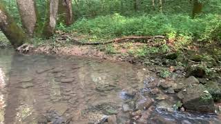
Photos of North Side - 91
Hiking Project is built by hikers like you. Add Your Photos