Continue with onX Maps
 Continue with Facebook


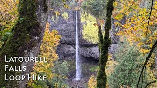
Columbia Gorge
 OR
OR- Columbia Gorge


Gems in Columbia Gorge - 5
Hiking Project is built by hikers like you. Add Your Gems


Recommended Routes in Columbia Gorge - 19
Hiking Project is built by hikers like you. Add Your Recommended Routes


 Intermediate/Difficult
Multnomah Falls Loop
4.8 mi 7.7 km • 1,554' Up 473.69 m Up • 1,510' Down 460.14 m Down
 Bridal…, OR
 Intermediate/Difficult
Eagle Creek Trail to Tunnel Falls
11.7 mi 18.8 km • 1,280' Up 390.28 m Up • 1,280' Down 390.29 m Down
 Cascade…, OR
 Intermediate/Difficult
Angel's Rest Lookout
4.1 mi 6.6 km • 1,441' Up 439.21 m Up • 1,439' Down 438.72 m Down
Bridal…, OR

 Difficult
Munra Point Out and Back
6.2 mi 10.0 km • 2,173' Up 662.39 m Up • 2,205' Down 672.21 m Down
Cascade…, OR
 Intermediate
Multnomah Falls Out and Back
2.7 mi 4.3 km • 868' Up 264.56 m Up • 868' Down 264.48 m Down
Bridal…, OR

 Very Difficult
Indian Point Loop
7.8 mi 12.6 km • 2,898' Up 883.39 m Up • 2,897' Down 883.11 m Down
Cascade…, OR
 Intermediate
Dry Creek Falls
4.4 mi 7.1 km • 734' Up 223.66 m Up • 734' Down 223.58 m Down

Columbia Gorge Hiking
- 447 Miles 720 Kilometers of Trail
- 19 Recommended Routes
- 5 Gems

- 41
Easy Trails

- 95
Intermediate Trails

- 37
Difficult Trails

Areas Within Columbia Gorge
Weather Averages
|
High
|
Low
|
Precip
|
Days w/
|
| J | F | M | A | M | J | J | A | S | O | N | D |
Trails in Columbia Gorge - 154
Hiking Project is built by hikers like you. Add Your Trails
|
12.9
mi
20.8
km
#1Eagle Creek Trail #440
Intermediate/Difficult
Cascade Locks, OR
|
Intermediate/Difficult
|
Cascade Locks, OR |
9
|
|
|
1.1
mi
1.8
km
#2Wahclella Falls Trail #436
Intermediate
Cascade Locks, OR
|
Intermediate
|
Cascade Locks, OR |
15
|
|
|
0.9
mi
1.4
km
#3Mitchell Point Trail
Intermediate/Difficult
Hood River, OR
|
Intermediate/Difficult
|
Hood River, OR |
7
|
|
|
1.1
mi
1.8
km
#4Munra Point Trail
Difficult
Cascade Locks, OR
|
Difficult
|
Cascade Locks, OR |
3
|
|
|
6.7
mi
10.8
km
#5Larch Mountain Trail #441
Intermediate/Difficult
Bridal Veil, OR
|
Intermediate/Difficult
|
Bridal Veil, OR |
13
|
|
|
8.6
mi
13.8
km
#6Oneonta Trail #424
Intermediate/Difficult
Bridal Veil, OR
|
Intermediate/Difficult
|
Bridal Veil, OR |
12
|
|
|
2.2
mi
3.6
km
#7Wahkeena Trail #420
Intermediate/Difficult
Bridal Veil, OR
|
Intermediate/Difficult
|
Bridal Veil, OR |
10
|
|
|
0.4
mi
0.6
km
#8White River Falls Trail
Intermediate/Difficult
The Dalles, OR
|
Intermediate/Difficult
|
The Dalles, OR |
1
|
|
0.1
mi
0.1
km
#9White River Falls Overlook
 Easy
Easy
The Dalles, OR
|
Easy
|
The Dalles, OR |
1
|
|
|
4.5
mi
7.2
km
#10Angel's Rest Trail #415
Intermediate/Difficult
Bridal Veil, OR
|
Intermediate/Difficult
|
Bridal Veil, OR |
13
|
Photos of Columbia Gorge - 272
Hiking Project is built by hikers like you. Add Your Photos