
 Continue with onX Maps
 Continue with Facebook


 Particularly Special Place


 Easy
Easy
Easy
Easy
 Easy
Easy
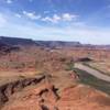
Land Manager: Dead Horse Point State Park
 Longbow Arch Trail (Longview Arch)
2.2 mi 3.5 km • 362' Up 110.3 m Up • 361' Down 110.13 m Down
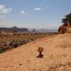
 Moab, UT
 Long Amasa Loop
15.1 mi 24.3 km • 1,993' Up 607.55 m Up • 1,996' Down 608.33 m Down
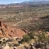
Moab, UT
 Corona Arch Trail
2.2 mi 3.6 km • 367' Up 112 m Up • 367' Down 111.92 m Down
 Moab, UT
Jeep Arch / Gold Bar Arch Trail
Moab, UT
Jeep Arch / Gold Bar Arch Trail
3.8 mi 6.1 km • 918' Up 279.82 m Up • 923' Down 281.31 m Down
Whale Rock Trail
0.5 mi 0.9 km • 78' Up 23.71 m Up • 77' Down 23.62 m Down
Hidden Valley Trail Out and Back
6.4 mi 10.4 km • 1,107' Up 337.31 m Up • 1,106' Down 337.09 m Down
Moab, UT


 All Clear


0 Comments