
 Continue with onX Maps
 Continue with Facebook


 Particularly Special Place


 Intermediate
Intermediate
Intermediate
 Intermediate
Land Manager: MA DCR - Mount Tom State Reservation
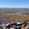
 Goat Peak Out-and-Back
0.9 mi 1.5 km • 277' Up 84.39 m Up • 277' Down 84.49 m Down
 Eastham…, MA
 Arcadia Walking Loop (No Running Allowed)
0.8 mi 1.4 km • 25' Up 7.7 m Up • 25' Down 7.63 m Down
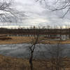
 Sanderson Brook Falls Trail
2.0 mi 3.2 km • 238' Up 72.54 m Up • 239' Down 72.79 m Down
Robert Frost Trail
40.2 mi 64.7 km • 5,360' Up 1633.58 m Up • 5,892' Down 1795.84 m Down
Wendell, MA
Northfield Mountain Trails
11.3 mi 18.3 km • 1,913' Up 583.11 m Up • 1,912' Down 582.9 m Down
 Shenipsit Trail
52.2 mi 84.0 km • 5,302' Up 1616.15 m Up • 5,210' Down 1587.93 m Down


0 Comments