
 Continue with onX Maps
 Continue with Facebook


 Particularly Special Place


 Difficult
Difficult
Difficult
 Difficult
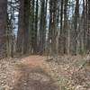
 Jackson Creek Trail
1.6 mi 2.6 km • 201' Up 61.12 m Up • 200' Down 61.04 m Down


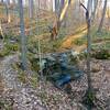
 Scarce O' Fat Loop
5.7 mi 9.2 km • 563' Up 171.58 m Up • 563' Down 171.62 m Down
Nashville, IN
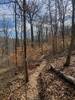
Pate Trail Loop
5.6 mi 9.1 km • 835' Up 254.38 m Up • 820' Down 250.02 m Down
 Schooner Trace-Walnut Loop
6.3 mi 10.2 km • 759' Up 231.42 m Up • 761' Down 231.96 m Down
Downey Hill Full Loop
5.0 mi 8.0 km • 553' Up 168.46 m Up • 557' Down 169.8 m Down
Nashville, IN
Sycamore Trail Loop
6.5 mi 10.5 km • 438' Up 133.46 m Up • 439' Down 133.71 m Down


0 Comments