
 Continue with onX Maps
 Continue with Facebook


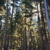
 Particularly Special Place


 Intermediate/Difficult

 Intermediate/Difficult
Land Manager: USFS - Willamette National Forest Office
 Odell to Windigo Loop
54.6 mi 87.8 km • 6,018' Up 1834.37 m Up • 6,019' Down 1834.59 m Down
 Pacific Crest Trail to Midnight Lake
7.2 mi 11.6 km • 820' Up 250.03 m Up • 821' Down 250.12 m Down
Diamond Peak Loop
24.8 mi 39.9 km • 2,816' Up 858.18 m Up • 2,817' Down 858.65 m Down
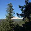
 Oakridge, OR
Tenas Peak Loop
Oakridge, OR
Tenas Peak Loop
13.0 mi 20.9 km • 2,303' Up 702.03 m Up • 2,303' Down 701.86 m Down
Erma Bell Lakes Loop
8.9 mi 14.3 km • 992' Up 302.24 m Up • 993' Down 302.52 m Down
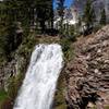
 Cottonwood Creek Falls
14.7 mi 23.6 km • 2,721' Up 829.47 m Up • 2,721' Down 829.31 m Down
Crater…, OR


0 Comments