
 Continue with onX Maps
 Continue with Facebook


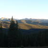
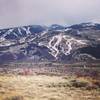
 Particularly Special Place


 Difficult
Difficult
Difficult
 Difficult
Land Manager: USFS - White River - Eagle-Holy Cross Ranger District
 Twin Meadows to Margy's Hut
4.6 mi 7.4 km • 1,978' Up 602.86 m Up • 117' Down 35.8 m Down
 Aspen, CO
 Beaver Lake Out and Back
4.9 mi 7.9 km • 1,307' Up 398.51 m Up • 1,307' Down 398.25 m Down
Berry Creek Infiniti Loop
5.7 mi 9.1 km • 1,139' Up 347.06 m Up • 1,151' Down 350.91 m Down
 Berry Creek Tour
16.8 mi 27.1 km • 4,191' Up 1277.56 m Up • 4,191' Down 1277.55 m Down
Margy's Hut to Lenado Trailhead
5.8 mi 9.3 km • 25' Up 7.72 m Up • 2,588' Down 788.7 m Down
Aspen, CO
Abrams Gulch Loop
8.5 mi 13.6 km • 1,335' Up 406.86 m Up • 1,321' Down 402.56 m Down


0 Comments