
 Continue with onX Maps
 Continue with Facebook


 Particularly Special Place


 Intermediate
Intermediate
Intermediate
 Intermediate
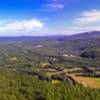
 Rattlesnake Mountain
2.5 mi 4.0 km • 938' Up 285.98 m Up • 937' Down 285.72 m Down

 Walter - Newton Loop
1.5 mi 2.5 km • 158' Up 48.3 m Up • 156' Down 47.69 m Down
Moose Mountain Trail
4.3 mi 6.9 km • 1,004' Up 306.13 m Up • 1,000' Down 304.88 m Down
 Rattlesnake
1.8 mi 2.8 km • 344' Up 104.84 m Up • 346' Down 105.33 m Down
 Holderness, NH
 Beaver Brook Out and Back
6.9 mi 11.1 km • 3,082' Up 939.27 m Up • 3,082' Down 939.48 m Down
Lincoln, NH
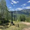
Snow's Mountain Lower Loop
3.4 mi 5.4 km • 807' Up 246.04 m Up • 804' Down 244.94 m Down


0 Comments