
 Continue with onX Maps
 Continue with Facebook


 Particularly Special Place


 Intermediate

 Intermediate
Land Manager: USFS - Arapaho & Roosevelt National Forests Office
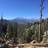
 Deer Mountain Loop
10.5 mi 16.9 km • 1,698' Up 517.54 m Up • 1,698' Down 517.52 m Down
 Estes Park, CO
 Beaver Boardwalk
0.1 mi 0.2 km • 3' Up 1 m Up • 3' Down 0.98 m Down
 Mummy Kill Route (Mummy Marathon)
17.4 mi 28.0 km • 4,920' Up 1499.48 m Up • 7,488' Down 2282.32 m Down
Estes Park, CO
 Lumpy Ridge Short Loop
1.6 mi 2.6 km • 400' Up 121.82 m Up • 378' Down 115.35 m Down
 Gem Lake and Balanced Rock
7.5 mi 12.0 km • 1,563' Up 476.26 m Up • 1,562' Down 476.24 m Down
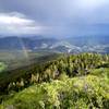
Storm Mountain
5.2 mi 8.3 km • 1,249' Up 380.61 m Up • 1,249' Down 380.59 m Down


 All Clear


0 Comments