
 Continue with onX Maps
 Continue with Facebook


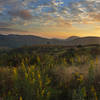
 Particularly Special Place


 Intermediate


 Intermediate
Land Manager: USFS - Nantahala National Forest Office
 Sam Knob Loop
9.8 mi 15.7 km • 1,393' Up 424.63 m Up • 1,402' Down 427.37 m Down
Brevard, NC
 Panthertown Valley Loop
5.5 mi 8.8 km • 822' Up 250.45 m Up • 791' Down 241.13 m Down
 Art Loeb - Little East Fork Loop
12.3 mi 19.8 km • 2,659' Up 810.48 m Up • 2,669' Down 813.37 m Down
Clyde, NC
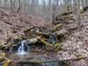
Full CM Gamelands Loop
12.2 mi 19.6 km • 3,002' Up 915.06 m Up • 2,998' Down 913.91 m Down
Big Green Mountain — Little Green Mountain Loop
8.5 mi 13.6 km • 1,173' Up 357.57 m Up • 1,172' Down 357.09 m Down
Brevard, NC
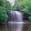
Twin Falls Out-and-Back
2.0 mi 3.2 km • 220' Up 67.07 m Up • 220' Down 67.09 m Down
Brevard, NC


0 Comments