
 Continue with onX Maps
 Continue with Facebook


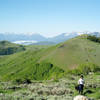
 Particularly Special Place


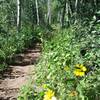
 Intermediate/Difficult
Intermediate/Difficult
Intermediate/Difficult
 Intermediate/Difficult
Land Manager: USFS - Uinta, Wasatch & Cache National Forests Office
 Ibantik Lake
8.5 mi 13.7 km • 1,123' Up 342.4 m Up • 1,123' Down 342.43 m Down

 Kamas, UT
 Silver Lake to Ontario Loop
3.9 mi 6.3 km • 1,058' Up 322.42 m Up • 1,057' Down 322.16 m Down
Lower Jenni's and CMG Loop
2.3 mi 3.7 km • 502' Up 153.03 m Up • 502' Down 152.93 m Down
Armstrong Spiro Loop
9.0 mi 14.5 km • 1,519' Up 462.95 m Up • 1,552' Down 472.96 m Down
 Grandaddy Basin Out and Back
13.8 mi 22.3 km • 1,785' Up 544.16 m Up • 1,785' Down 544.04 m Down
Deso-Crest-Dog Loop
12.9 mi 20.8 km • 2,770' Up 844.37 m Up • 2,769' Down 843.89 m Down
Alta, UT


1 Comment