
 Continue with onX Maps
 Continue with Facebook


 Particularly Special Place


 Intermediate
Intermediate
Intermediate
 Intermediate
Land Manager: USFS - Chattahoochee-Oconee National Forest
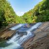
 Panther Falls
6.7 mi 10.8 km • 396' Up 120.74 m Up • 396' Down 120.8 m Down

 Clarkes…, GA
Bridal Veil Falls
Clarkes…, GA
Bridal Veil Falls
1.8 mi 2.9 km • 593' Up 180.76 m Up • 593' Down 180.8 m Down
Clayton, GA
 Yonah Mountain Trail #632
4.6 mi 7.4 km • 1,471' Up 448.34 m Up • 1,471' Down 448.23 m Down
Cleveland, GA
 Anna Ruby Falls Trail #15
1.0 mi 1.5 km • 221' Up 67.38 m Up • 221' Down 67.25 m Down
 Raven Cliffs Falls
5.5 mi 8.8 km • 895' Up 272.91 m Up • 895' Down 272.79 m Down
Cleveland, GA
Brasstown Bald via Jack's Gap
5.8 mi 9.3 km • 2,179' Up 664.28 m Up • 2,179' Down 664.01 m Down
Hiawassee, GA


0 Comments